
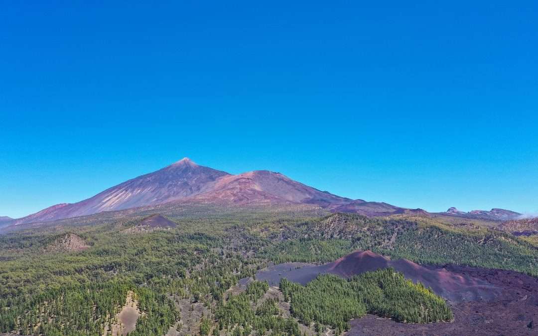
You can see Mount Teide from almost anywhere in Tenerife, and sooner or later everyone who visits the island wants to get closer. Driving up to Las Cañadas is easy. Reaching the summit is another story: you need a booking, you usually pay a fee, and rangers on the trail check that you carry the required gear.
This guide covers what you need to know before you go, based on the rules published by the Cabildo de Tenerife in October 2026. At the end we suggest our guided hikes, where you walk with Teide right in front of you and no quota to worry about.
Mount Teide in numbers
The peak is 3,715 metres high according to the official survey by Spain’s National Geographic Institute. Older signs and guidebooks still say 3,718 metres, a figure calculated back in the 1970s.
Measured from the ocean floor it rises more than 7,500 metres, and UNESCO regards it as the third tallest volcanic structure in the world. That is one reason the park is a World Heritage Site. Another is the sea of clouds, which keeps changing the colours and textures of the landscape through the day.
How to get to Teide National Park
By car you can drive up from La Orotava in the north, from La Esperanza in the northeast or from Vilaflor in the south. The cable car base station has a car park with about 220 spaces, so in high season it pays to arrive early.
If you would rather not drive, two TITSA buses go up to the park. Each one makes a single trip up in the morning and back in the afternoon:
- Line 342, from the south. It leaves Costa Adeje bus station at 9:25 and stops in Los Cristianos at 9:40. On the way back it leaves the cable car stop at 15:40.
- Line 348, from the north. It leaves Puerto de la Cruz bus station at 9:30 and La Orotava at 9:45. The return bus leaves the cable car stop at 16:05.
That gives you enough time for the cable car or a short trail, but not for hiking up from the bottom. Check the TITSA website before you set off, as timetables can change.
Reaching the summit: cable car, permit and eco fee
The cable car runs from the base station at 2,356 metres to La Rambleta at 3,555 metres. Tickets are sold by the operator, Volcano Teide.
From La Rambleta to the crater there are about 160 metres left to climb on the PNT 10 Telesforo Bravo trail. It is short, but some stretches reach a 60% gradient and you start walking above 3,500 metres, so you will feel the altitude. Take it slowly and stop whenever you need to.
That last stretch needs a permit from Tenerife ON. Your cable car ticket does not include access to the summit.
How booking works
- You book on the Tenerife ON website with a registered and validated account. A new week of places opens every Monday at 7:00 (Canary Islands time).
- Each permit covers a 90 minute time slot for up to 9 people.
- You can only book one slot per day, and the system will not give you another place in the seven days before or after your date.
- No permits are issued between 22:00 and 6:00. The sunrise slot, from 6:00 to 7:30, is for people staying overnight at the Altavista refuge.
- Children under 3 are not allowed, and children aged 3 to 16 must be with an adult. Pets are not allowed either, except guide dogs.
How much it costs
Since 19 January 2026 the two trails that reach the top charge a fee between 9:00 and 17:00. These are the current prices:
- PNT 10 Telesforo Bravo (summit access): free for Tenerife residents and children under 14, €6 for residents of the other Canary Islands and €15 for visitors from outside the islands.
- PNT 07 Montaña Blanca to La Rambleta: free for Tenerife residents. Other Canary Islands residents pay €3 on weekdays and €5 at weekends and on public holidays, and visitors from outside pay €6 and €10.
You get your money back if you ask at least three days in advance, if the trail is closed or if the cable car stops running that day.
Required gear
At the checkpoint they can ask to see your gear and turn you away without it, even with a booking. The reason is simple: if the cable car stops because of a breakdown or bad weather, you have to walk down very steep ground with big swings in temperature.
For PNT 10 you must carry long trousers (worn or in your backpack), a fleece or similar warm layer even in summer, and hiking boots or closed trekking shoes with good grip. If you hike up via Montaña Blanca, add a phone with enough battery, an emergency thermal blanket, water, a hat and gloves, and a torch or headlamp.
Hiking up via Montaña Blanca
The classic route on foot starts at Montaña Blanca, passes the Altavista refuge and ends at La Rambleta. To the summit it is about 9 kilometres and 6 to 7 hours of climbing, with stretches steeper than 60%. Tenerife ON rates it as a high difficulty trail. You need a booking for PNT 07 and, if you want to reach the crater, for PNT 10 as well.
In winter: ice, snow and closures
When there is snow or ice, the Cabildo closes the upper trails of the volcano completely or in part. On those days you may need a valid mountaineering federation card, a signed declaration when you book and specific gear such as crampons and an ice axe. The day before, check the notice on the trail page in Tenerife ON and the AEMET mountain forecast, which is far more reliable for the summit than the local town forecast.
Things to do in the park without going to the summit
If you cannot get a permit, the trip is still worth it. The best known trail is the Roques de García loop (PNT 03): 3.5 kilometres, about two hours and barely 200 metres of elevation gain. It is easy, needs no booking and passes Roque Cinchado, La Catedral and the lava flow known as La Cascada.
Guided hikes with views of Mount Teide
You can also enjoy Teide from outside the quota areas. On our hikes you go with a local mountain guide, and accident and rescue insurance, permits and a photo report are included.
Chinyero Volcano
This is the one we recommend if you want to see Teide. It is a 6.6 km loop of 3 to 4 hours, easy, with only 170 metres of elevation gain. You walk through Canary pine forest and the lava flows of Chinyero, the last volcano to erupt in Tenerife, with Teide and Pico Viejo ahead of you for much of the way. We meet at 9:30 at the Mirador de Los Poleos viewpoint. See the Chinyero hike.
From Erjos to Monte del Agua
An 11 km walk through the laurel forest in the northwest of the island, 4 to 5 hours long, with 400 metres of elevation gain and a low to moderate difficulty. We start at 9:30 from the square in Erjos. See the Erjos hike.
Forest of Enigmas in Anaga
If you have a few more days on the island, pair Teide with the laurel forest of Anaga, at the other end of Tenerife. It is 5.5 km and about 3 hours, easy, with 190 metres of elevation gain. We meet at 9:00 at the Cruz del Carmen car park. See the Forest of Enigmas hike.
All our routes, with dates and prices, are on our hiking in Tenerife page.
Frequently asked questions
Do I need a permit to enter Teide National Park?
No. You can drive or take the bus into the park, stop at the viewpoints and walk trails such as Roques de García without booking anything. You only need a permit for the trails on the volcano itself, such as PNT 10 to the summit or PNT 07 from Montaña Blanca.
Can I reach the summit with just a cable car ticket?
No. The cable car takes you to La Rambleta at 3,555 metres. For the last stretch to the crater you need the PNT 10 permit.
How much does it cost to climb to the summit of Teide?
The PNT 10 permit costs €15 if you live outside the Canary Islands and €6 if you live on another island. It is free for Tenerife residents and children under 14. The cable car is paid separately.
What can I do if I can’t get a permit?
Go anyway. Walk the Roques de García loop, which is open to everyone, or join us on the Chinyero volcano hike to walk with Teide right in front of you.
Information checked in November 2026 against the rules of the Cabildo de Tenerife, Tenerife ON and TITSA. Fees and timetables can change, so please confirm them before your visit.
Recent Comments